The Margaret River region occupies the far south-western corner of Australia, a ridge of limestone and granite between Cape Naturaliste in the north and Cape Leeuwin in the south. It's best known for its wine, but it's just as rewarding for surf beaches, coastal walking, limestone caves, tall karri forest and small towns with good food. It's an easy first regional trip from Perth and rewards a longer stay.
This guide covers how to get there, the main areas of the region, what to see and do, when to go and how to stay safe on its wild coast.
~270 km
From Perth to the town
About three hours by road
~124 km
Cape to Cape Track
Lighthouse to lighthouse
Two capes
Naturaliste and Leeuwin
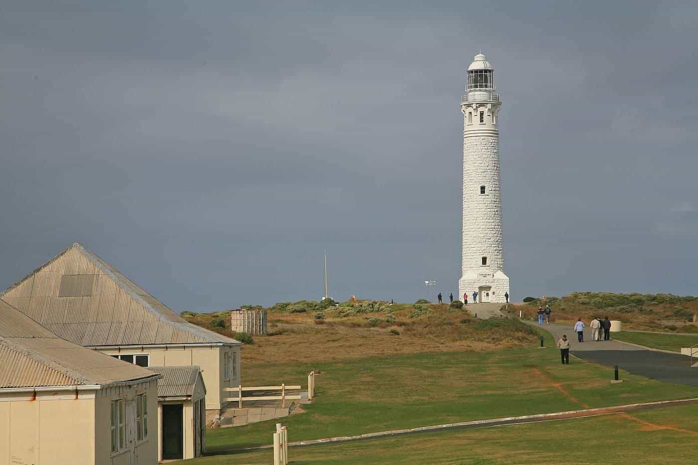
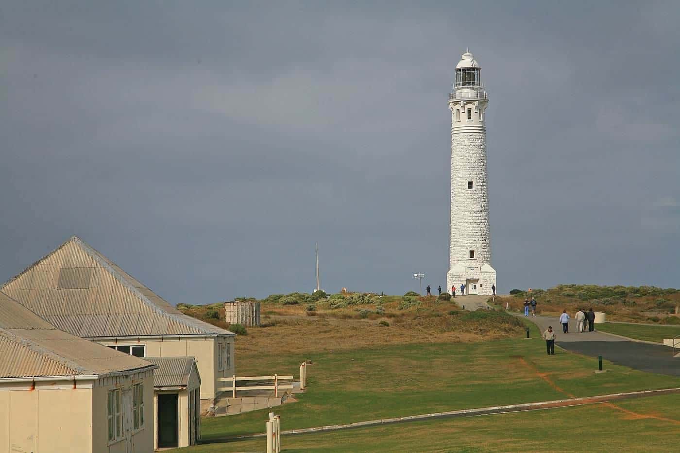
Lighthouses at each end
Getting there and getting around
Most visitors drive. The usual route runs south from Perth on the Kwinana Freeway and Forrest Highway to Bunbury, then follows the Bussell Highway past Busselton to the town of Margaret River. Regional airports and coach services link the South West with Perth, but a car gives you the freedom to reach beaches, caves and forest that public transport doesn't serve.
Distances within the region are short by Western Australian standards. Dunsborough, Yallingup, Margaret River and Augusta are all within easy reach of each other, so you can base yourself in one town and make day trips. Roads are winding in places, and kangaroos are active at dawn and dusk, so slow down outside towns.
The main areas
Geographe Bay and Busselton. The calm, north-facing waters of Geographe Bay suit families and swimmers. Busselton's long timber jetty reaches far out into the bay and is one of the area's best-known landmarks.
Dunsborough and Cape Naturaliste. At the northern tip, Cape Naturaliste has a lighthouse and walking trails with views over the bay. Sheltered beaches such as those around Meelup are popular in summer.
Yallingup and the surf coast. South of the cape, the coast swings to face the Indian Ocean. Surf breaks around Yallingup and Margaret River are well known among surfers, and the granite headlands are dramatic in any weather.
Margaret River town. The town sits on the Margaret River a short drive inland from the river mouth at Prevelly. It's the region's main hub for accommodation, food and services.
Augusta and Cape Leeuwin. In the far south, Augusta sits near the mouth of the Blackwood River. Nearby Cape Leeuwin, the south-westernmost point of mainland Australia, is where the Indian and Southern oceans meet, with a historic lighthouse.
Caves
The Leeuwin-Naturaliste Ridge is made of limestone, and the region has hundreds of caves. A handful are open to the public, some with self-guided boardwalks and others with guided or adventure tours. Several show caves are run as paid attractions. Cave temperatures stay cool year round, so caves are a good option in hot weather or rain. Wear sturdy shoes and follow guides' instructions, and never enter unmanaged caves.
Walking the Cape to Cape Track
The Cape to Cape Track runs about 124 km between the two lighthouses, mostly within Leeuwin-Naturaliste National Park. It follows clifftops, beaches and forest, and passes through some of the region's most beautiful coastline. Walking the full track usually takes five to seven days, with campsites along the way. Many people walk shorter sections as day walks.
Sections on soft sand are slow going. Carry plenty of water, check river mouth crossings and tide conditions, and plan for exposure to sun and wind. Check Parks and Wildlife Service WA for current track alerts and campsite information.
Beaches and ocean safety
The region's beaches range from sheltered coves to exposed reef breaks with heavy surf. Conditions can change quickly.
- Swim at patrolled beaches between the red and yellow flags where possible.
- Look for rips: darker, calmer-looking channels between breaking waves.
- Never turn your back on the ocean when on rocks. King waves have swept rock fishers and sightseers into the sea along this coast.
- Wear a lifejacket when fishing from rocks, and check the swell forecast before you go.
Surf Life Saving's Beachsafe website lists beaches, hazards and patrol times.
Whale watching
Humpback whales travel along the Western Australian coast during their annual migration, and southern right whales visit sheltered bays in winter. From about June to December, whales can be seen from headlands and on boat tours from Augusta and around Geographe Bay. Sightings vary, so take binoculars and be patient. Boats must follow rules on approach distances to whales.
Food and wine
Wine is the region's best-known industry, with many cellar doors spread through the countryside. There are also breweries, distilleries, cheese makers, chocolate makers, farm gates, markets and cafes. If you plan to taste wine, organise a designated driver or take a tour. Western Australia's drink-driving laws are strictly enforced, and random breath testing is common on regional roads.
Forests and inland
Inland from the coast, forests of karri, jarrah and marri line quiet roads. Karri are among the tallest trees in Australia, and the forest drives and walks near Margaret River and further south towards Pemberton are a cool contrast to the beaches. Cycling and mountain bike trails also attract visitors.
When to go
The South West has a Mediterranean-type climate: warm, dry summers and cool, wet winters.
- Summer (December to February) brings warm weather, busy beaches and peak accommodation demand, particularly over school holidays.
- Autumn (March to May) is often settled and pleasant, with fewer crowds.
- Winter (June to August) is wetter and cooler, with big swells, cosy cellar doors and the start of whale season.
- Spring (September to November) brings wildflowers along the coast and whales passing.
Summer is also bushfire season. Check Emergency WA for fire warnings and total fire bans, and know what to do if a fire threatens.
Margaret River trip checklist
0 of 8 done
Ticks are saved in this browser only.
Suggested itineraries
Weekend. Base yourself in Dunsborough or Margaret River. Spend a morning on the beaches and Cape Naturaliste, an afternoon in the wine and food country, and a second day visiting a cave and the coast near Prevelly.
Four to five days. Add Augusta and Cape Leeuwin, a forest drive, a section of the Cape to Cape Track and a whale-watching tour in season.
A week or more. Walk the Cape to Cape Track, or continue east through the forests to Pemberton, Walpole and on to Albany and the Great Southern.
Accommodation and booking
The region has everything from caravan parks and national park campgrounds to motels, holiday homes and boutique stays. Peak periods book out well ahead, so plan early for summer, Easter and school holidays. National park campsites need to be booked online in advance. Check cancellation policies, and confirm what's included before you pay.
Travelling responsibly
The coast and forests are fragile. Stay on marked tracks, take your rubbish with you, don't feed wildlife and keep dogs out of national parks where they aren't allowed. The South West is Wadandi and wider Noongar country; look for Aboriginal-led cultural experiences and respect places of cultural significance.
Common mistakes
- Trying to see the whole region in one day. Distances are short, but there's a lot to see.
- Underestimating the ocean. Rock platforms and surf beaches can be deadly in big swell.
- Not booking ahead in summer and school holidays.
- Driving at dusk without watching for kangaroos.
Travelling with children
The region is family-friendly, with sheltered bays at Geographe Bay, short coastal and forest walks, caves with boardwalks and plenty of farm-gate stops. Choose calm, patrolled beaches, pack sun protection and keep a close eye on children near rocks, cliffs and water.
Key points
The Margaret River region is about three hours south of Perth and combines surf coast, caves, forests and food and wine country. Base yourself in one town, allow several days, respect the ocean, book ahead in peak season and check park and fire information before you go.
Frequently asked questions
How far is Margaret River from Perth?
The town of Margaret River is roughly 270 km south of Perth by road, usually about three hours of driving via the Kwinana Freeway, Forrest Highway and Bussell Highway. Allow longer in holiday traffic.
How long is the Cape to Cape Track?
The Cape to Cape Track runs about 124 km between the lighthouses at Cape Naturaliste and Cape Leeuwin, mostly through Leeuwin-Naturaliste National Park. Most walkers take five to seven days to walk the full track, but many people walk short sections as day walks.
When can I see whales near Margaret River?
Humpback whales migrate along the WA coast in winter and spring, and southern right whales visit sheltered bays in winter. Whale watching from Augusta and from Geographe Bay is popular from roughly June to December. Sightings depend on the year and the animals.
Is it safe to swim at Margaret River beaches?
Many beaches in the region have powerful surf, strong rips and rocky reefs. Swim at patrolled beaches between the flags where available, check conditions and never fish or walk on exposed rocks in big swell, where king waves have swept people into the sea.
Do I need a park pass in Leeuwin-Naturaliste National Park?
Park entry fees apply at some sites in the park, and some caves and lighthouses are run as paid attractions. Check the Parks and Wildlife Service WA website for current fees and passes before you go.
Can I visit Margaret River without drinking wine?
Yes. The region has beaches, surfing, caves, forest walks, lighthouses, cycling trails, galleries, breweries, cafes and food producers. Wine is one part of a much bigger picture.
Sources and further reading
Facts on this page were checked against these primary and official sources. Conditions change — confirm before you travel or buy.
- Leeuwin-Naturaliste National Park — Parks and Wildlife Service WA
- Cape to Cape Track — Parks and Wildlife Service WA
- Travel map and road conditions — Main Roads WA
- Beachsafe — Surf Life Saving Australia