Broome is a laid-back town on the edge of the Kimberley, with a famous beach, a pearling history and spectacular sunsets over the Indian Ocean. Beyond it lies the Kimberley, a remote region larger than many countries, with gorges, waterfalls, ancient rock art, huge tidal rivers and the beehive-shaped domes of the Bungle Bungle Range. It's one of the great travel experiences in Australia, but it needs careful planning.
This guide covers Broome, the main Kimberley regions, the Gibb River Road, Purnululu, the wet and dry seasons, and crocodile and remote-travel safety.
May–Oct
Dry season
Best time to visit
~660 km
Gibb River Road
Mostly unsealed
2003
Purnululu World Heritage
Bungle Bungle Range
Getting there
Broome is roughly 2,200 to 2,400 km from Perth by road, depending on route, and most visitors fly. Driving from Perth is a long road trip, usually combined with the Coral Coast, Ningaloo, Karijini and the Pilbara. Kununurra, in the East Kimberley, also has flights and connects to the Northern Territory by road.
Broome
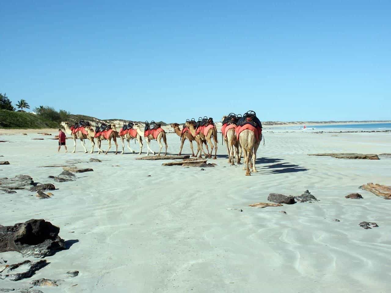
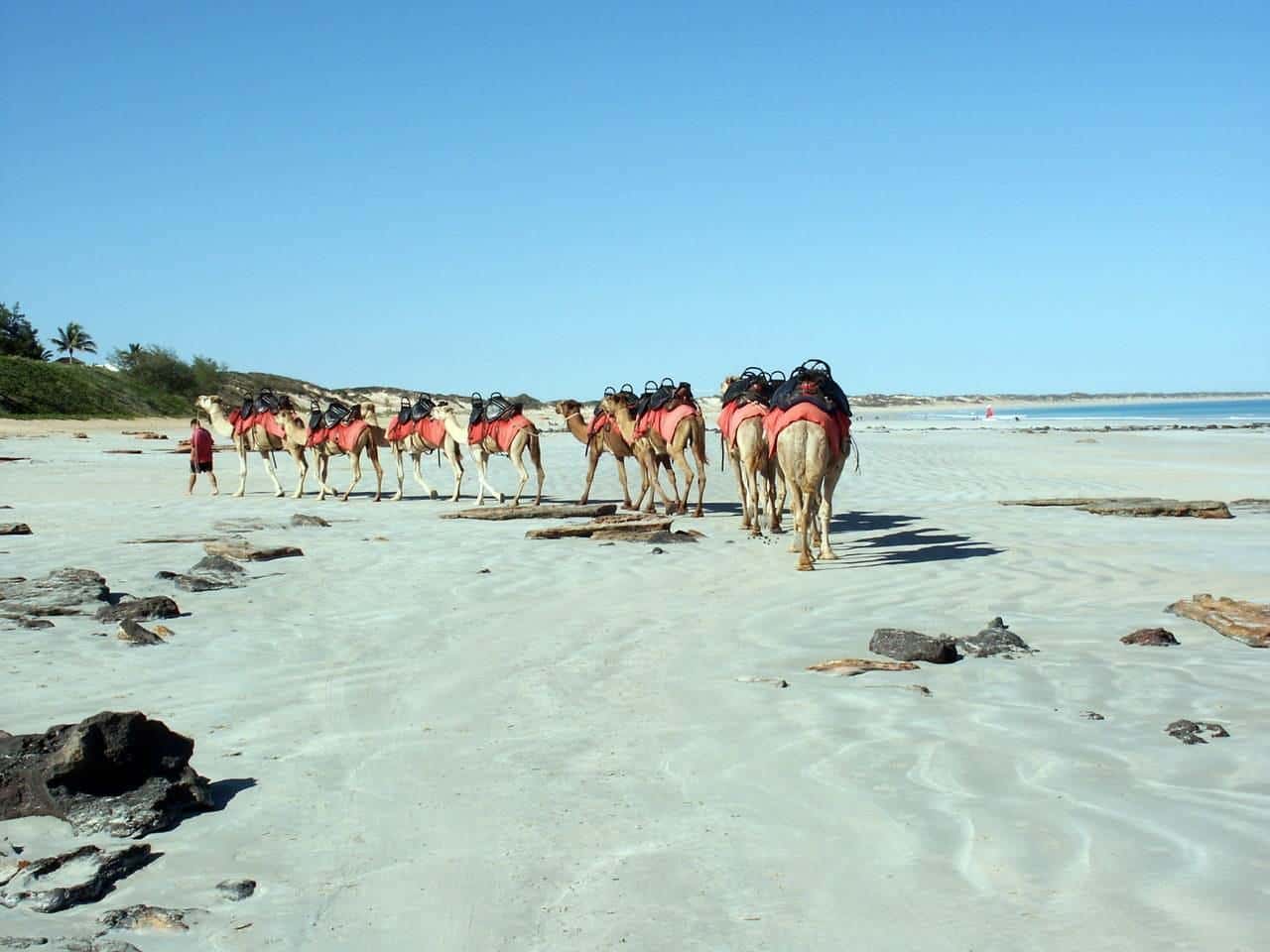
Cable Beach. Broome's best-known beach stretches for more than 20 km. Sunset camel rides along the sand are a classic Broome experience. In the dry season, swimming is popular; in stinger season, be aware of box jellyfish.
Pearling history. Broome grew as a pearling centre in the late nineteenth century, drawing divers and workers from Japan, China, Malaysia, Indonesia and the Philippines. The Japanese Cemetery, Chinatown and local museums tell this multicultural history.
Gantheaume Point. Red cliffs meet the sea at Gantheaume Point. At very low tides, dinosaur footprints can be seen in the rocks nearby.
Staircase to the Moon. On some nights around the full moon between about March and October, the rising moon reflects off the exposed mudflats of Roebuck Bay, creating the illusion of a staircase to the moon. Check local information for dates.
The Dampier Peninsula
North of Broome, the Dampier Peninsula has red cliffs, white beaches and Aboriginal communities welcoming visitors to cultural tours, fishing and camping. Roads have been improved, but some tracks need a four-wheel drive. Some communities require permits or bookings, and some areas are closed to visitors. Check before you go.
The Gibb River Road
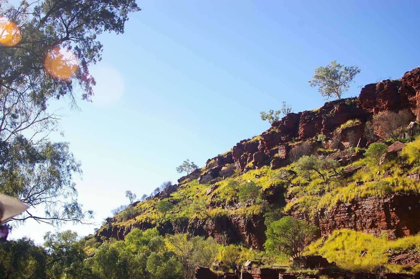
The Gibb River Road runs about 660 km through the heart of the Kimberley between Derby and the Kununurra area. It was originally built to move cattle and is mostly unsealed. Side tracks lead to gorges, waterfalls and swimming holes, including Windjana Gorge, Tunnel Creek, Bell Gorge and Manning Gorge.
The road requires a well-prepared high-clearance four-wheel drive, good tyres, spares, recovery gear, extra fuel and water, and a satellite communication device. River crossings can be deep early in the season. The road is generally only open in the dry season and can close after rain. Check Main Roads WA for current conditions.
Purnululu National Park
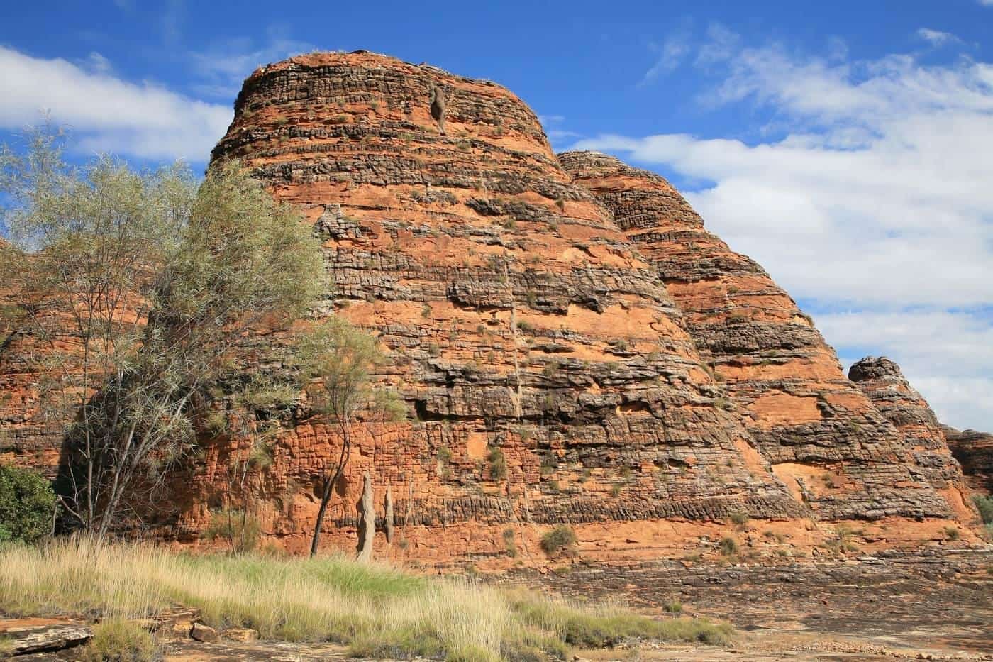
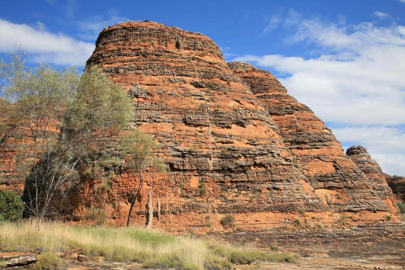
Purnululu National Park, in the East Kimberley, protects the Bungle Bungle Range, a maze of striped, beehive-shaped sandstone domes. The park was inscribed on the World Heritage List in 2003. Walks lead into Cathedral Gorge, Echidna Chasm and Piccaninny Creek. The park is open in the dry season only and is reached by a rough four-wheel-drive access track. Scenic flights are a popular way to see the range from above.
Kununurra and the East Kimberley
Kununurra is the main town in the East Kimberley, near Lake Argyle, one of Australia's largest artificial lakes, created by the Ord River Dam. The Ord River and Lake Argyle offer boat cruises, and Mirima National Park, close to town, has formations similar to the Bungle Bungles.
The coast
The Kimberley coast is rugged, remote and mostly reached by boat or plane. Expedition cruises explore its gorges, waterfalls and rock art. The Horizontal Falls in Talbot Bay, where huge tides surge through narrow gaps, are seen on scenic flights and boat tours.
Wet and dry seasons
The Kimberley has two main seasons.
- Dry season (roughly May to October). Warm, sunny days, cooler nights, and most roads, parks and tours open. This is peak season.
- Wet season (roughly November to April). Heat, humidity, storms, heavy rain and cyclones. Many roads close, rivers flood and some parks and businesses close. Waterfalls are spectacular from the air.
Crocodile safety
Saltwater crocodiles live in rivers, estuaries, billabongs, beaches and coastal waters across the Kimberley. They're dangerous and can attack without warning.
- Never swim where crocodiles may be present. Follow signs, but don't assume it's safe if there's no sign.
- Stay well back from the water's edge, and don't clean fish or prepare food near the water.
- Camp at least 50 m from the water's edge.
- Never dangle arms or legs over the side of boats.
Kimberley trip checklist
0 of 8 done
Ticks are saved in this browser only.
Common mistakes
- Attempting the Gibb River Road without a properly prepared four-wheel drive.
- Swimming in crocodile country.
- Visiting in the wet season without understanding closures.
- Underestimating distances, fuel needs and the time required.
Accommodation and booking
Broome and the Kimberley's main towns have hotels, resorts, caravan parks and holiday rentals, while remote areas have station stays, wilderness camps and national park campgrounds. The dry season is peak season, so book well ahead. Some remote accommodation closes during the wet season.
Tours and flights
Scenic flights, boat tours and guided four-wheel-drive tours are popular ways to see remote parts of the Kimberley without the challenges of driving yourself.
Respecting culture
Broome and the Kimberley have strong Aboriginal cultures. Aboriginal-led tours offer insights into country, history and bush foods. Respect signs at culturally significant places.
Key points
Broome and the Kimberley are best visited in the dry season, from about May to October. Allow plenty of time, prepare thoroughly for remote travel, never swim in crocodile country, check permits and road conditions, and consider flights or tours for remote areas.
Frequently asked questions
When is the best time to visit Broome and the Kimberley?
The dry season, roughly May to October, is the best time. Days are warm and sunny, and most roads, parks and tours are open. The wet season, roughly November to April, brings heat, humidity, heavy rain, cyclones and road closures.
What is the Staircase to the Moon?
On some nights around the full moon between about March and October, the rising moon reflects off exposed tidal flats in Roebuck Bay, creating an illusion of stairs climbing to the moon. It depends on a full moon rising over a very low tide.
Can I swim at Cable Beach?
Cable Beach is popular for swimming in the dry season. Box jellyfish and other marine stingers can be present, mainly from about November to May, and crocodiles can occur in Kimberley waters. Swim in patrolled areas, follow signs and lifeguard advice, and wear a stinger suit in stinger season.
Do I need a four-wheel drive for the Gibb River Road?
Yes. The Gibb River Road is a mostly unsealed, remote road of about 660 km between Derby and the Kununurra area, with river crossings and corrugations. It requires a well-prepared high-clearance four-wheel drive and is generally only open in the dry season.
How do I see the Bungle Bungles?
The Bungle Bungle Range in Purnululu National Park can be reached by high-clearance four-wheel drive on a rough access track in the dry season, or seen on scenic flights from Kununurra and nearby areas.
Are there crocodiles in the Kimberley?
Yes. Saltwater crocodiles live in rivers, estuaries, billabongs and coastal waters across the Kimberley, and freshwater crocodiles are found inland. Never swim where crocodiles may be present, and follow all signs.
Sources and further reading
Facts on this page were checked against these primary and official sources. Conditions change — confirm before you travel or buy.
- Purnululu National Park — UNESCO World Heritage Centre
- Be Crocwise — Department of Biodiversity, Conservation and Attractions
- Gibb River Road — Main Roads WA
- Tropical cyclones — Bureau of Meteorology